Street plan of the English, French and American settlements
Item
-
Title
-
Street plan of the English, French and American settlements
-
Description
-
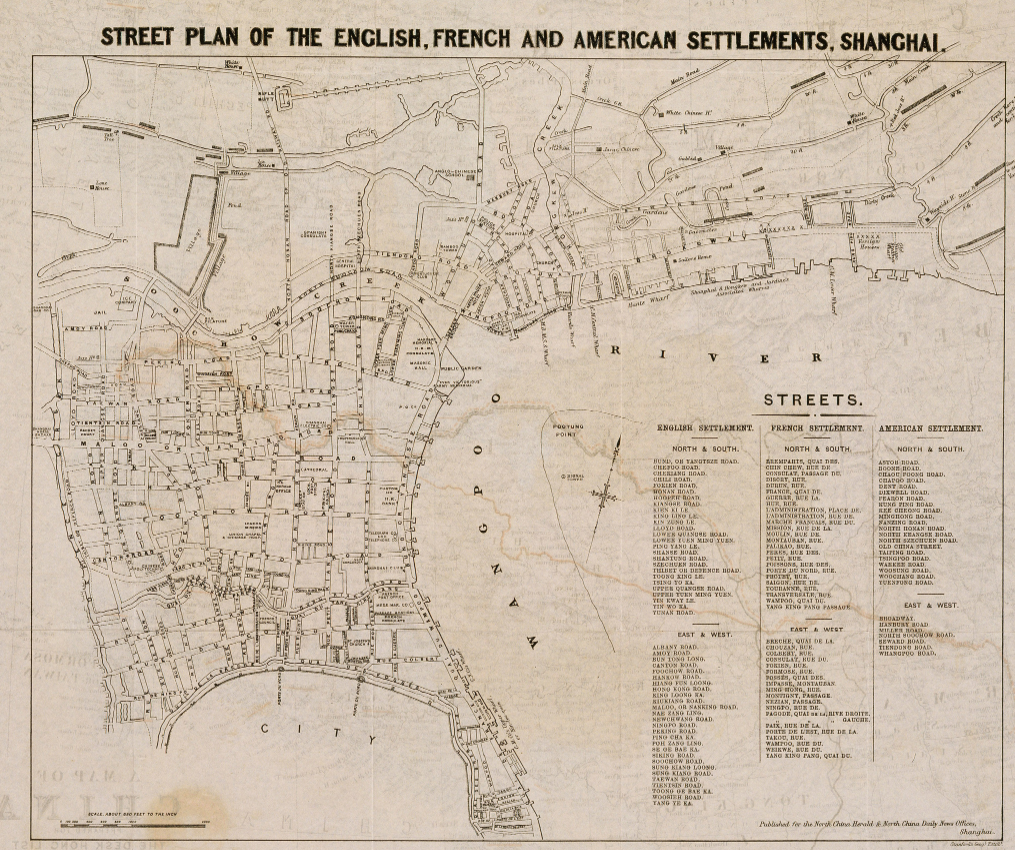
This map depicts the street plan of the English, French, and American settlements in Shanghai as of 1870. The map was created by the English mapmaking company Stanford's Geographical Establishment in order to be published in the English-language Shanghai newspaper North China Daily News. The map has a 1 : 10,200 scale and is oriented more or less North to South, though it is rotated slightly clockwise. While the map lacks a conventional legend, it does have a list of every major street in each of the foreign settlements off to the side. These streets are also labelled on the map, which also notes some significant locations or landmarks.
The North China Daily News was the most influential foreign newspaper in China from the mid 19th to early 20th centuries. Its audience would primarily have been the Shanghai's English-speaking population of English and Americans. The map reflects this, as it transliterates the Chinese names of streets into the English alphabet. Somewhat interestingly, the map leaves the names of streets in the French settlement unchanged, using French words like "rue" (street). While the map depicts the foreign settlements in great detail, it leaves a large blank space where the old walled city of Shanghai would be. This might indicate that that area was thought of as irrelevant to the readers of the North China Daily News, implying that foreigners rarely visited the Chinese part of the city. Furthermore, that the map depicts all of the foreign settlements implies that foreigners moved between settlements instead of simply remaining in those of their respective nations. People only need detailed street maps of places they intend to visit.
-
Contributor
-
Liam Marshall
-
Creator
-
Stanford's Geographical Establishment
-
Source
-
Virtual Shanghai
-
Date
-
c. 1870
-
Coverage
-
Shanghai foreign settlements, 1870