Shanghai 1884
Item
-
Title
-
Shanghai 1884
-
Description
-
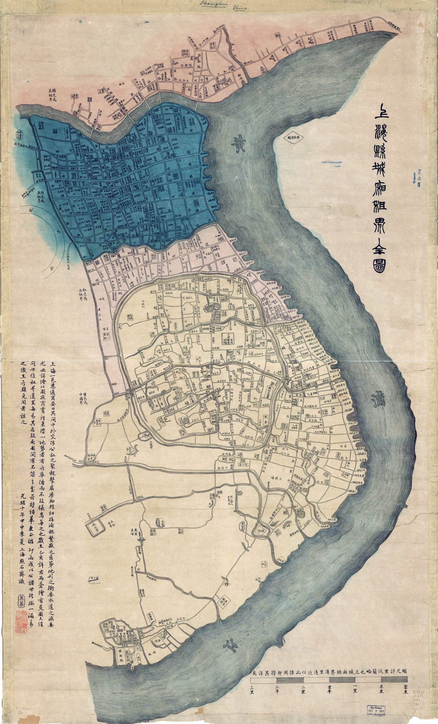
Originally drawn by Yucang Xu in 1875, later edited and published by Dian She Zhai in 1884, this map depicts the urban layout of Shanghai in 1884. The map includes both the county and foreign concessions with distinctions as follows: Chinese area in yellow, French in red, British in blue, and American in orange. The map contains Chinese text, describing various locations in the city.
The Huangpu river takes up the right portion of the map, and using it as a geographical marker sans included compass allows us to assume the top portion of the map corresponds to north, and the bottom portion the south. The map is scaled 1:5400 and was originally drawn on paper, measuring 110 x 66 cm.
-
Contributor
-
Dian Shi Zhai
-
Subject
-
Shanghai: County and Concessions
-
Creator
-
Yucang Xu
-
Source
-
Library of Congress
-
Publisher
-
Dian Shi Zhai
-
Date
-
1884
-
Format
-
Digital Image
-
Language
-
Chinese
 Shanghai 1884